
How to get here.
Five simple steps from Masjid As-Sajidin to the gate, about 2.2 km. Every landmark and coordinate below was recorded on the actual route.
- 2.2 kmMosque to gate
- 5Written steps
- 400 mThe last stretch, Jalan Cikgu Enal
Before you set off
Search for Laman Pok Nik in Google Maps.
Google Maps
Type Laman Pok Nik into Google Maps, or tap the button below. The route takes you to the gate.
Waze and other apps
Waze does not yet show the access road correctly, and we have not checked other apps. Do not search by name or address in those apps.
Set your navigation to Masjid As-Sajidin on the main road. From the mosque, follow the five steps below.
The route
From the mosque to the gate
About 2.2 km by road. The route diagram follows your progress as you scroll.
Photographed from the driver's seat on 11 September 2026, in the order you will see them. A route diagram drawn from the actual road. Please follow the written steps and landmarks.
- Tarred road, about 1.3 km
- Gravel track, about 470 m
- Jalan Cikgu Enal, about 400 m
Step 01
Turn at Masjid As-Sajidin
Leave the main road at the mosque. From here it is about 2.2 km by road to the gate.
3.472181, 101.639408- Tarred road, about 1.3 km
- Gravel track, about 470 m
- Jalan Cikgu Enal, about 400 m
Step 02
Follow Jalan Kampung Sentosa
Continue east through the village of Kampung Sentosa.
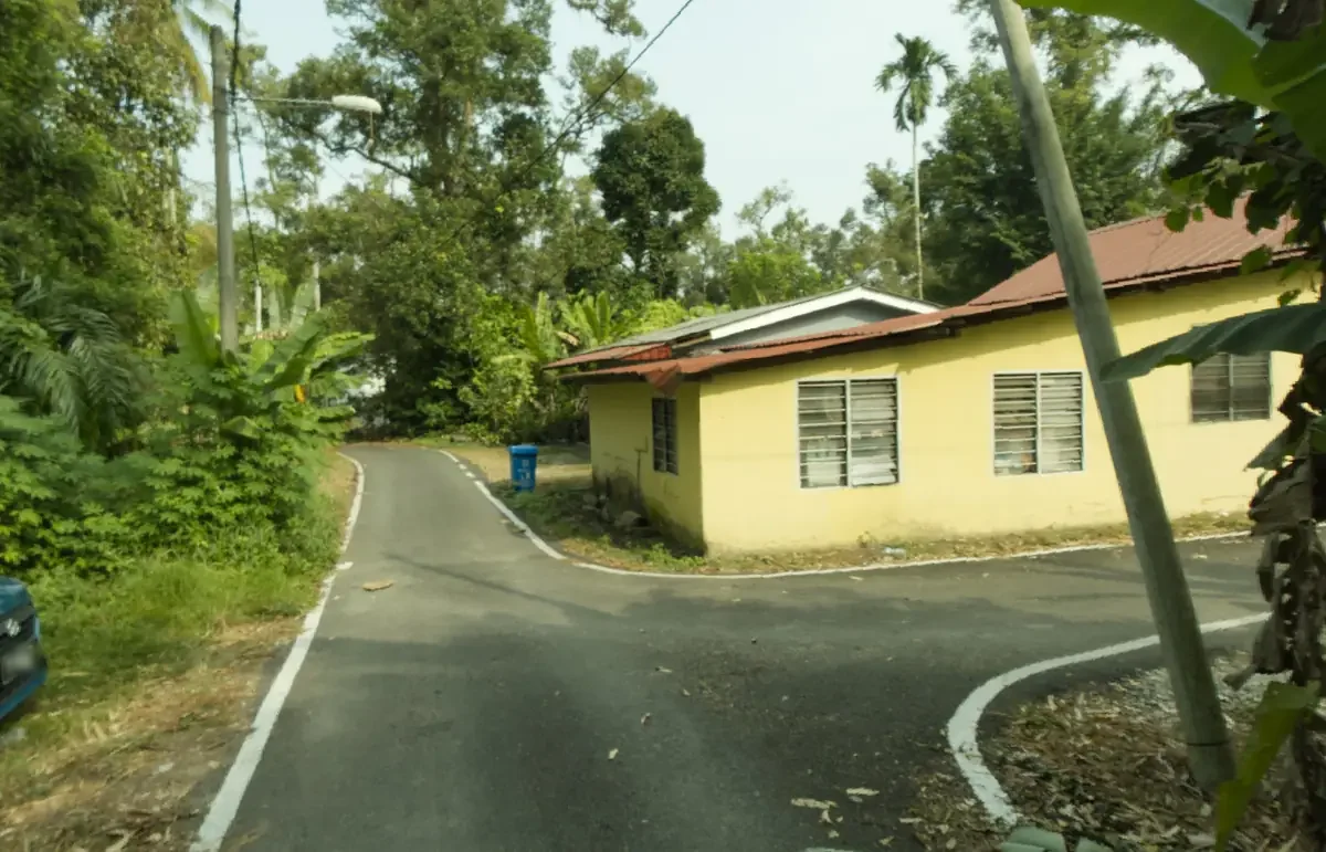
The yellow house. Just past it the tar ends and the gravel begins.
Step 03
Pass the yellow house, where the tarred road ends
Look for a single storey yellow house with a red roof where the road bends. Just after it, the tarred road ends. Continue straight onto the gravel road.
3.469082, 101.650714Keep going here. After the yellow house, the tarred road ends and the road turns to gravel. This is correct. The gravel road is part of the route, and the gate is a few hundred metres beyond the junction at its end.
If you have passed the yellow house and are on gravel, you are on the right road. Please continue.
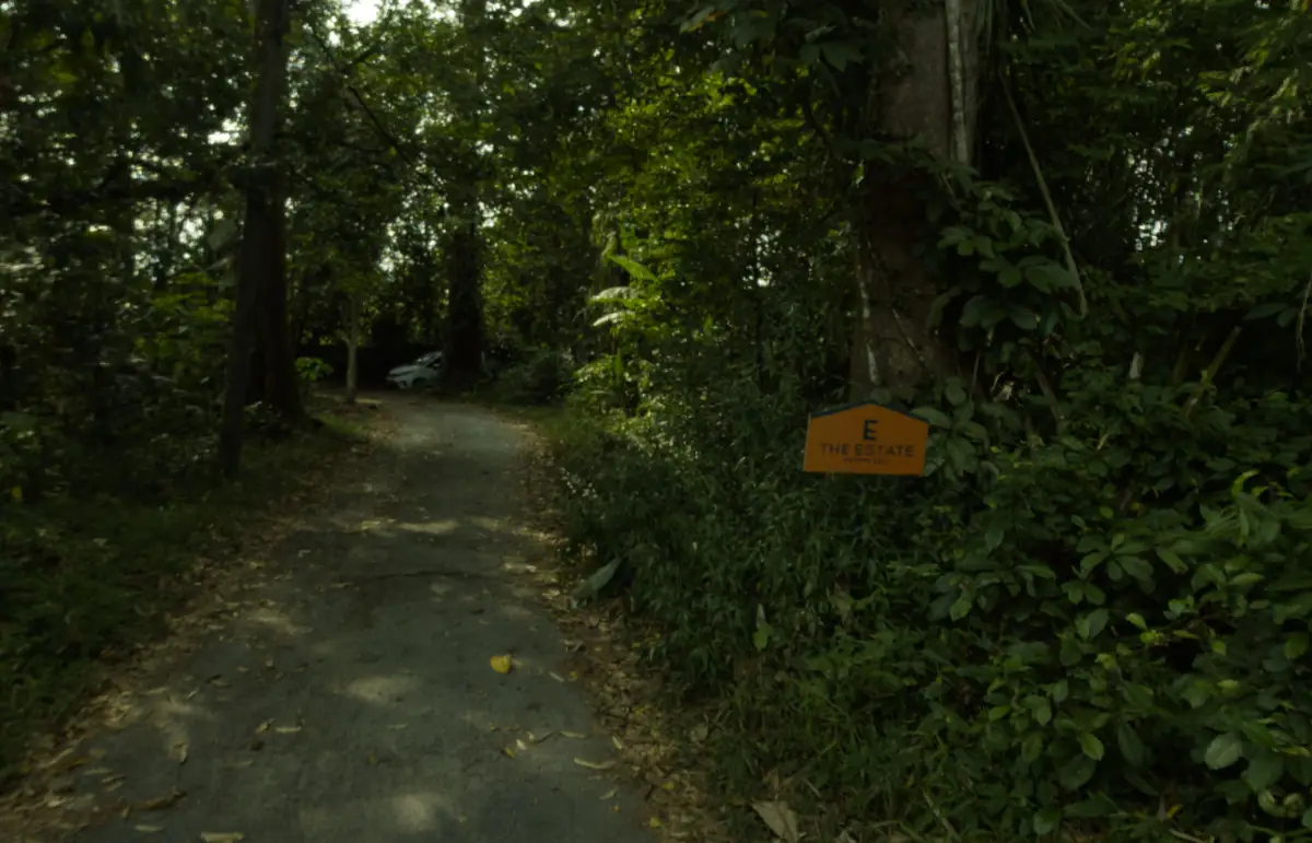
The gravel stretch under the trees, with an orange sign reading THE ESTATE at the roadside.
Step 04
Continue on the gravel road, then turn right into Jalan Cikgu Enal
At the end of the gravel road, turn right into Jalan Cikgu Enal. This road now appears on Google Maps, but may not yet appear on other map apps.
3.471045, 101.653967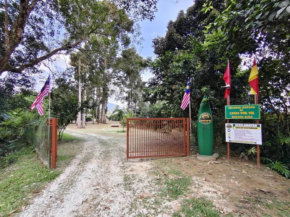
The Laman Pok Nik gate, with the 443 marker and signs.
Step 05
Arrive at the gate, about 400 m ahead
Look for the brown iron gate. Beside it stand a green surfboard-shaped marker numbered 443 with the Laman Pok Nik logo, and the Selamat Datang sign. You have arrived.
3.4680369, 101.6557123- ABrown gate
- BMarker 443
- CWelcome sign
- DSafety sign
Distances
Distances
Distances by road.
| Leg | Distance |
|---|---|
| The Jalan Cikgu Enal junction to the gate | About 400 m |
| Masjid As-Sajidin to the gate, by road | About 2.2 km |
The address
Lot 443, Jalan Cikgu Enal,
Kampung Rantau Panjang,
44300 Batang Kali, Selangor.
The entrance coordinate
Plus Code FM94+67 Batang Kali
The final stretch of road
From the yellow house to the gate, the road is gravel and unlit. It is suitable for ordinary cars. Arriving in daylight is recommended.
There is no signage along the final 400 m of Jalan Cikgu Enal. Please continue until you reach the gate.
If you are bringing a caravan
Caravans are welcome at Laman Pok Nik. Please check the road with Nik Hazmi before you set off.
The final stretch is unlit gravel with a turn at the end. Please message Nik Hazmi about your vehicle before you travel, and plan to arrive in daylight.
Need help on the way?
Call or WhatsApp Nik Hazmi. He can guide you in from wherever you are.
WhatsApp Nik Hazmi